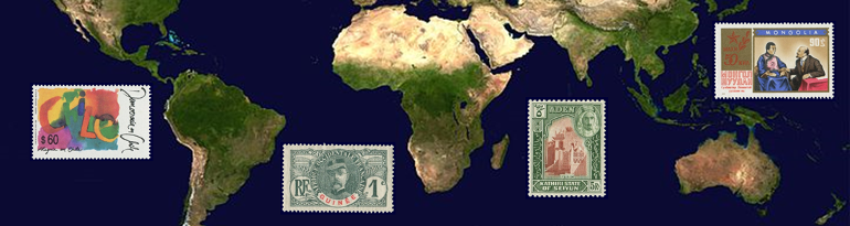
This is a site for stamp collectors. It provides information on the historical context of stamps issued worldwide. The site is primarily aimed at the worldwide collector.
(22-02-2017) Please read: Health news
The site contains a number of sections as follows:
Country profiles
The main body of the site consists of country profiles with a description of a country’s political and postal history. Countries both past and present.
A standard layout

Chile – 1990. Issued to commemorate the return to democracy.
A country profile has a standard layout: a summary with key characteristics and sections on the political history and postal history of the country. Each country profile contains one or more custom made maps to illustrate the political and postal history of the country. Each country profile links to album pages from my personal collection.
Each profile is written so that it can be read independent of other profiles. The advantage of this is that the need for referrals is minimized. The downside is that you will come across redundant text in the profiles.
In the profiles you will find links to the Glossary of political terms and to related profiles.
The list of countries
The list of countries for which profiles are developed is based on the setup of the Michel world wide catalog as published in the 1990’s. The setup of catalogs differs and changes over time. Thus, the list of countries would be different if based on another catalog, or even on the current version of the Michel catalog. This is one of the reasons why an index is provided. Please refer to the Index section to find countries not found in the menu.
The use of resources

French Guinea – 1906. General Faidherbe. A design also used in other French colonies in French West Africa.
Several resources are used for the development of profiles. For all profiles the resources, as listed in the Resource section of this site, are used. In addition many country specific resources are used – these being mainly online resources. The resources used do not always concur on the interpretation of – even the facts of – history. In such cases I have made a choice of which resources to follow based on my best judgement. Only when differences between resources really seem to make an essential difference in understanding the course of history, I have added a note on the different interpretations found in the resources.
Current scope
The site currently contains a complete set of country profiles for the countries of Africa, the Americas, Asia and Oceania & Antarctica. Thus over 350 profiles are available, including over 1 750 stamp issuing entities. Currently I am working on the profiles for Europe.

Profiles available – Please click on the image to enlarge
Country diagrams
In addition to the country profiles, what I call country diagrams are provided. Country diagrams are flow charts that show the political and postal development of – mostly a group of – countries.
Legend
In the diagrams I have used a standard color coding to identify differences in political status. Furthermore, the diagrams may include periods in which countries have issued stamps and periods in which no stamps have been issued. The legend is as follows:

Please click on the image to enlarge
Finally, dates of political changes are indicated in standard font, dates for postal changes in italic.
Maps
All country profiles contain one or more maps. The maps are custom made – often using multiple sources – to illustrate the political and postal history of a country. The Maps section of the site contains a number of additional maps.
Continent maps
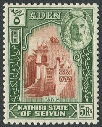
Aden, Kathiri State of Seiyun – 1942. Issued by one of the emirates in the protectorate of Aden.
Maps are provided of the continents in order to locate countries worldwide. Continent maps have been developed for both the colonial and the modern era.
Country specific maps
Country specific maps are included in the country profiles. However, I have made maps of a selected number of countries in advance of making the corresponding country profile. These maps I have, for now, posted in the Maps section of the site. They will at some point be moved to the respective country profiles.
Although I try to make the maps self explanatory and add a short introduction to each map, they will, of course, be better understood when there is the full text of a country profile to support them. Please feel free to ask any questions you may have by leaving a comment.
Stamp issuing entities

Mongolia – 1971. Mongolian leader Sükhbaatar meets Soviet leader Lenin.
This section contains a list of stamp issuing entities. The goal is to provide a reference list of stamp issuing entities of past and present within the scope of the four leading worldwide catalogs – stamp issuing entities that are either listed in or referred to by these catalogs. The catalogs used to set up the list are:
- Michel: Deutschland, Europa and Überseekatalog
- Scott: Standard Postage Stamp Catalog
- Stanley Gibbons: Stamps of the World
- Yvert & Tellier: Catalogue de Timbres-Poste
The list is set up in such a way that it can also be used to manage the scope of a worldwide collection. The list is updated periodically.
Glossary, Index and Resources
To support other sections of the site, a glossary of political terms is provided, an index of all stamp issuing entities described in the country profiles and a list of resources used.
Through this site I aim to add something to the base of knowledge of the stamp collecting community. As there will always be room for improvement, responses to improve the pages on this site are most welcome.