Belgian Congo
Quick reference
General issues: Congo Free State 1886-1908, Belgian colony 1908-1960
Country name on general issues: Etat Ind(ependant) du Congo, Congo Belge/Belgisch Congo
Special issues: Belgian occupation of German East Africa: General issues 1916-1922, Issues Ruanda 1916, Issues Urundi 1916
Currency: 1 Franc = 100 Centimes
Population: 4 103 000 in 1900, 14 169 000 in 1965
Political history Belgian Congo

Please click on the image to enlarge
The Belgian Congo is located in central Africa. In the middle of the 19th century Congo is inhabited by a large number of different Bantu peoples and a small number of Pygmy peoples. The Congo basin is one of the last parts of Africa to draw the interest of the colonial powers. In the second part of the 19th century it is Leopold II, king of Belgium, who founds an organization to acquire the rights over Congo – the Association Internationale du Congo. He does so in a personal capacity, not as the king of Belgium. The Belgian government rejected a colonial endeavor as too risky. Leopold II is successful: in 1885 at the conference of Berlin where the spheres of influence of the colonial powers in Africa are divided, Congo is awarded to the Association Internationale du Congo. In 1886, Leopold II establishes the Congo Free State ruled in personal union by Leopold II himself. The borders of Congo are largely drawn at the Berlin conference. From 1894 to 1910, Leopold leases the Lado exclave from the British. Minor border corrections are effected with Uganda in 1910 and 1914.
The Congo Free State is, in subsequent years, run as an exploitation colony. Humanitarian values are neglected to such an extent that in 1908, under international pressure, Leopold II is forced to cede Congo to the Belgian government. Congo thus becomes a Belgian colony. For the Belgian government, Congo is still an exploitation colony rather than a settler colony. However, the Belgian government does invest in economic infrastructure, education and health care. In the 1950’s, the call for independence of Congo becomes louder and in 1960 independence is gained as the republic of Congo. Congo is renamed Zaire in 1971, to go back to Congo in 1997.
Belgian Congo was actively involved in WWI. The Belgians occupy parts of German East Africa in 1916. The Belgian and British efforts topple the German colonial regime in German East Africa. Most of German East Africa is, after WWI, awarded to Great Britain as Tanganyika. Ruanda-Urundi is awarded to Belgium at the treaty of Versailles in 1919 to become a Belgian mandated territory by decree of the League of Nations in 1922. Ruanda-Urundi will be under Belgian administration until 1962, when Ruanda gains independence as the republic of Rwanda and Urundi as the kingdom of Burundi.
Postal history Belgian Congo

1931 – Kivu kraal
The first stamps for Congo Free State are issued in 1886, these, from 1908, to be superseded by the issues of Belgian Congo. The first Belgian Congo issue is an overprint reading ‘Congo Belge’ which has been applied both in Brussels and in Congo in several types. The first definitives are issued in 1909. In 1960, the issues of Belgian Congo are superseded by the issues of the republic of Congo, in 1971 by those of Zaire and in 1997 again by those of the – then democratic – republic of Congo.
For the occupied territories in German East Africa, stamps are issued from 1916 until 1922. The first general issues are stamps of Belgian Congo overprinted ‘Est Africain Allemande Occupation Belge/Duitsch Oost Afrika Belgische Bezetting'[1]French and Dutch for ‘German East Africa Belgian Occupation’ . In 1922, these are reissued with an additional overprint of a new face value. A further set is issued in 1918, stamps of Belgian Congo overprinted ‘A.O.’ for ‘Afrique Orientale’. Local issues have appeared for Ruanda and Urundi, the overprints reading ‘Ruanda’ and ‘Urundi’. Stamps with similar overprints for several other locations in German East Africa – Kigoma and others – are not recognized by the catalogs.
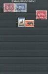
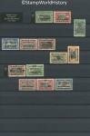
Album pages
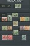
Page 1 of 5
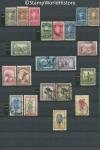
Page 2 of 5
Page 3 of 5
Page 4 of 5
Page 5 of 5
← Previous page: BechuanalandNext page: Benin →
Gerben- you are putting up new posts very quickly! Impressive!
You keep this up, and without a doubt, your site will be the best new contribution to WW classical collecting on the web in 2015! (My opinion.)
Your maps are quite nice for each country. How do you make them?
All the best!
Jim Jackson
Jim
That is a truly majestic compliment! I’ll make sure to live up to the expectations! The fact that I am at the moment able to post content at a relatively high pace is due to the fact that I have developed a lot of content over the past years. That was in Dutch so currently I am mainly translating already available content and making it ready for publication on the web.
As for the maps…
The process of map making begins with the decision which elements of the political and postal history of a country I want to show on the map. Next I start looking for maps that contain – part of – those elements. For the more complex maps I may use 6, 7, 8 different maps. Fortunately most map makers use the same projection so you can combine several maps into one. I find these maps on the internet or scan them from hard copy atlases. They may be modern maps or period maps.
The actual map making I do in Powerpoint, which I was thoroughly familiar with when I started map making. Obviously Powerpoint is not a professional tool for map making but it gets me where I want to be. I can think of only one thing for which I have had to develop a work around in Powerpoint compared to professional software. I draw the maps using a drawing tablet – essential. I draw the maps with the image 400% enlarged so that I get maximum detail.
A simple, straight forward map will take me a couple of hours to make, complex maps may take up to several days.
All in all I am quite happy to thus be able to 1) make exactly the maps I want and 2) do so in a standard template. On the site you will find that most everything that is described in the text of a country profile is reflected in the maps.
Finally: thanks again for putting a link on your site. Quite a few people have used it.
Gerben
Gerben,
I note a small error in the last paragraph of the Political history section: WWII instead of WWI.
Jeff
Thanks Jeff, it’s corrected.