Nyasaland
Quick reference
General issues: British protectorate 1908-1953, British protectorate 1963, British protectorate, self government 1963-1964
Country name on general issues: Nyasaland
Special issues: Occupation issues German East Africa, Nyasaland Force 1916-1917
Currency: 1 Pound = 20 Shilling, 1 Shilling = 12 Pence 1907-1953 and 1963-1964
Population: 947 000 in 1910, 3 794 000 in 1964
Political history Nyasaland
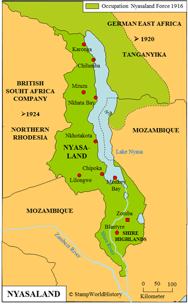
Nyasaland is located in eastern Africa. In the 19th century the future Nyasaland is inhabited by several different population groups. Some of these groups originate from the kingdom of Maravi that was at its height in the 17th century, when it contained most of what will become Nyasaland. Some population groups are relatively new to the country as they migrated into the country when the power of the Maravi kingdom was waning. A migration that would continue until the early 20th century.
The British establish, in the 1860’s and 1870’s, a limited presence in the country, specifically in the Shire Highlands. In 1889, the British form the Shire Highlands protectorate, which in 1891 is extended to become the British Central Africa protectorate. In 1907, the name of the protectorate is changed to Nyasaland. Nyasaland, together with Northern Rhodesia and Southern Rhodesia – the current Zimbabwe and Zambia – from 1953 until 1963, forms the federation of Rhodesia & Nyasaland. Nyasaland gains self government in 1963. Nyasaland gains independence within the British Commonwealth in 1964 as Malawi and in 1966 becomes the republic of Malawi as we know it today.
During WWI, Nyasaland and Northern Rhodesia are used by the British as a staging ground for the attack on German East Africa in 1916. From 1916, a force called the Nyasaland Force[1]Also known as Nyasaland Field Force or Nyasaland-Rhodesia Field Force. occupies parts of German East Africa. The Nyasaland Force consists of recruits from Nyasaland, Northern and Southern Rhodesia and South Africa. The efforts of the Nyasaland Force, together with the efforts of the Belgians from Belgian Congo, the British also invading from British East Africa and the Portuguese invading from Mozambique lead to an Allied victory in German East Africa. German East Africa is occupied, and in 1922 is split up into the British mandated territory of Tanganyika and the Belgian mandated territory of Ruanda-Urundi. For more information please refer to the profile of German East Africa.
Postal history Nyasaland
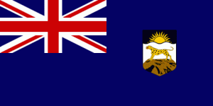
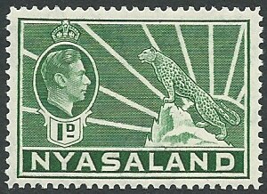
The first stamps used in Nyasaland are the issues of British Central Africa from 1891. Nyasaland issues stamps from 1908 – the first issues inscribed ‘Nyasaland Protectorate’ and later issues, from 1934, inscribed ‘Nyasaland’. Most issues are of the general designs for the British colonies – two sets show the national symbol of the leopard in front of the rising sun. From 1954 until 1963, the issues of the federation of Rhodesia & Nyasaland are used. After the dissolution of the federation, Nyasaland will first issue a set of provisionals in 1963 – revenue issues overprinted ‘Postage’ and a new face value. A final set of definitives is issued in 1964 after Nyasaland has gained self government. The stamps of Nyasaland are, from 1964, superseded by those of Malawi.
During WWI, the Nyasaland Force has issued stamps for use in the territories it had occupied in German East Africa. These are earlier issues of Nyasaland overprinted ‘N.F.’ for ‘Nyasaland Force’.
Album pages
← Previous page: Nossi-BéNext page: Nyassa Company →


