Caribbean Netherlands
Quick reference
General issues: Postal area of the Netherlands 2010-Present
Country name on general issues: Caribisch Nederland
Special issues: Regional issues Bonaire, Saba and Sint Eustatius 2014-Present
Currency: 1 Gulden = 100 Cents 2010, 1 Dollar = 100 Cents 2011-Present
Population: Bonaire 17 400 in 2013, Saba 2 000 in 2013, Sint Eustatius 3 900 in 2013
Political history Caribbean Netherlands
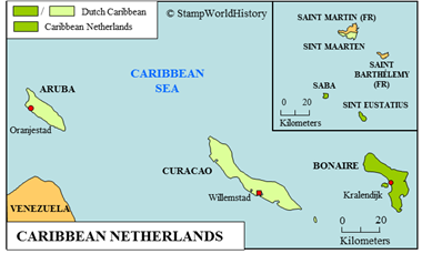
The Caribbean Netherlands – indeed: located in the Caribbean – consists of three islands. Bonaire is part of the Leeward Antilles[1]The western part of the Lesser Antilles located off the coast of Venezuela. , while Saba and Sint Eustatius are part of the Leeward Islands[2]The northern part of the Lesser Antilles. . For the exact location, please refer to the map of the Caribbean
Bonaire was, prior to colonization, inhabited by the Amerindian Caquetio people originating from Venezuela. The first Europeans to explore Bonaire were the Spanish in 1499. The Spanish claimed and settled the island. The Dutch first settled on Bonaire in 1636 and sovereignty over the island was transferred from the Spanish to the Dutch in 1648.
Saba and Sint Eustatius were, prior to colonization, inhabited by the Carib, an Amerindian people found on many of the Lesser Antilles. The first European to sight the islands was Christopher Columbus in 1493. The Spanish claimed, but did not settle, the islands. The Dutch established the first permanent settlements on Sint Eustatius in 1636 and on Saba in 1640. In 1648, the sovereignty over the islands was transferred from Spain to the Dutch.
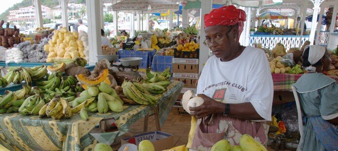
Local market on one of the islands
Together with the other Dutch possessions in the Caribbean – Aruba, Curacao and Sint Maarten – all three islands were, initially, administered by the Dutch West India Company, a chartered company. In 1791, the islands were transferred to the Dutch Crown. Throughout the 17th and 18th centuries, the islands were disputed – and, at times, occupied – by the British and the French, until Dutch sovereignty was fully acknowledged in 1815. From 1848, the islands were administered as dependencies of the colony of Curacao & Dependencies. Curacao & Dependencies was renamed the Netherlands Antilles in 1948. In 1954, the Netherlands Antilles became a constituent country in the Kingdom of the Netherlands and, as such, self governing. The Netherlands Antilles were dissolved in 2010. Bonaire, Saba and Sint Eustatius opted to become part of the Netherlands as municipalities with a special status – which they are until today. Together, they are commonly called the ‘Caribbean Netherlands’.
Economically, the islands, currently, largely depend on tourism. In terms of per capita GDP, they rank among the wealthier islands in the Caribbean. The main population groups are people of mixed European and African descent and people of European descent.
Postal history Caribbean Netherlands
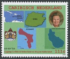
The first post offices were opened on the islands in the 1880’s. Initially, the stamps of Curacao & Dependencies were used. These were superseded by the issues of the Netherlands Antilles in 1948. Since 2010, the islands jointly issue stamps as the Caribbean Netherlands – the first issue commemorating the newly achieved status as Dutch municipalities. Initially, stamps were inscribed ‘Caribisch Nederland’ only. From 2014, the stamps are also inscribed with the names of the individual islands.[3]Whether these issues are to be considered regional issues, or a way to triple the revenues from the collectors market, is disputed. The Michel catalog lists the issues under three different stamp issuing entities, Scott under the one single entity of the Caribbean Netherlands.
Album pages
← Previous page: Canadian Provinces - Prince Edward IslandNext page: Cayman Islands →

