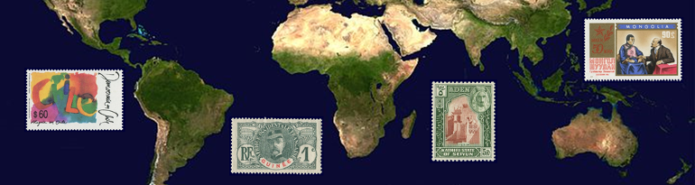
Ecuador
Quick reference
General issues: Republic 1865-Present
Country name on general issues: Ecuador
Special issues:
- Local issues: Guayaquil 1896-1897, Chimboraz0 1897
- Provincial, local & private issues 1902: Azuay, Bolivar, Chimborazo, Esmeraldas, Ferrocarril Guayaquil-Quito, Guayas, Leon, Loja, Los Rios, Pichincha, Tulcan, Tunguragua
- Provincial issues 1907: Azuay, Bolivar, Canar, Carchi, Chimborazo, El Oro, Esmeraldas, Guayas, Imbabura, Leon, Loja, Los Rios, Manabi, Pichincha, Tunguragua
- Private issues: SCADTA Ecuador 1928-1931
- Regional issues: Galapagos Islands 1957-1959
Currency: 1 Peso = 8 Reales = 100 Centavos 1865-1881, 1 Peso Fuerte = 10 Reales = 100 Centavos 1881-1884, 1 Sucre = 100 Centavos 1884-2000, 1 Dollar = 100 Cent 2000-Present
Population: 1 271 000 in 1900, 15 740 000 in 2013
Political history Ecuador
From Spanish rule to independence
Ecuador is located in South America. Before colonization, Ecuador is home to a number of Indian civilizations. In the 15th century these are conquered by the Inca who establish Quito – the current capital – as an administrative center in the Inca Empire, second only to the Inca capital of Cuzco in Peru. The Spanish conquer Quito in 1534 and establish the Audiencia of Quito that, during Spanish rule, alternatively will be part of the Viceroyalty of New Granada and the Viceroyalty of Peru.
After Napoleon has conquered Spain, what will become independence movements are triggered all throughout the Spanish possessions in South America. Quito rebels in 1809 and independence is declared in 1810 – an independence that is short lived as royalists loyal to Spain quench the independent State of Quito in 1812. In 1820 Guayaquil declares independence followed by other cities. Independence from Spain is finally brought about through the intervention of Simón Bolívar from Gran Colombia. The final battle is fought at Pichincha, just outside of Quito, in 1822. Ecuador subsequently becomes part of Gran Colombia – officially the republic of Colombia – that also encompasses the current Colombia, Panama and Venezuela. When in 1830 Gran Colombia breaks up, Ecuador gains full independence – first as the state of Ecuador and, from 1835, as the republic of Ecuador. Independence of Ecuador is recognized by Spain in 1840.

Please click on the image to enlarge
Establishing the borders
The newly established state of Ecuador, from 1830, lays claim to the territory of the former Audiencia of Quito. This brings Ecuador into conflict with other countries equally claiming parts of the same territory: Brazil, Colombia and Peru. In defining the borders between the former Spanish possessions, it is accepted as a guiding principle to follow the borders between the political entities in colonial times – the ‘uti possidetis juris’ principle. In this case, that principle does not provide an easy solution. Disputed are just exactly which decrees of the Spanish crown apply and how these should be interpreted. Peru, furthermore, states that a more important principle is the right of self determination – some contested regions have, in 1821, declared independence and have voted for association with Peru. In particular with Peru, the dispute will be a lengthy one that will lead to armed conflicts several times. With Brazil, a treaty is signed in 1904 in which Ecuador cedes the eastern most part of the claimed territory to Brazil. With Colombia, a treaty is signed in 1916. Colombia in 1922 signs a further treaty with Peru defining the current border between these two countries. With Peru, several treaties are signed that are either not ratified or nullified shortly after being signed. Meanwhile, from the 1850’s, Peru gains de facto control over most of the disputed territory – which an 1890 non ratified treaty seems to reflect. The conflict with Ecuador once more escalates into war in 1941. In 1942 the Rio Protocol is signed defining most of the border between Ecuador and Peru. Demarcation leads to a continued conflict over small stretches of the border. After armed border conflicts in 1981 and 1995, these last stretches of the border are finally agreed upon in 1998, thus ending one of the longest boundary disputes in modern history. The dispute is reflected in the fact that both period and modern maps may show very different borders depending on what position the mapmaker would take in the dispute.
The Galapagos Islands – about 1 000 kilometers of the coast of Ecuador in the Pacific Ocean – are annexed by Ecuador in 1832.
Political and economical developments
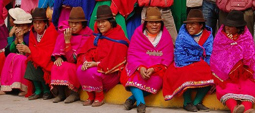
The Mestizo – people of mixed European and Amerindian origin – form the largest population group in Ecuador.
Ecuador is a country with many opposing groups: estate owners versus landless farmers, conservatives versus liberals, the coastal regions versus the highland regions in the Andes, the urban areas versus the rural regions, the administrative capital of Quito versus the commercial capital of Guayaquil and opposing population groups. The often conflicting interests of these groups seem to have led to a political history in which Ecuador has known few periods of political stability and have brought the country on the brink of civil war more than once. Authoritarian civilian regimes and military dictatorships have dominated the political arena and have followed each other often in rapid succession from independence until recent times. Although Ecuador has, since 1979, been ruled by democratically elected presidents, political instability is still an issue – few of the presidents elected since 1979 have served their full term.
Economically Ecuador is qualified as a middle high income economy. The most important export product is oil – accounting for over 50% of the exports. In the agricultural sector bananas are the cash crop – Ecuador being the largest exporter of bananas in the world. The largest population group are the Mestizo – people with mixed European and Amerindian origins – with 72% of the population. Afro-Ecuadorians, Amerindians, Europeans and the Montubio – a group recognized in 2001 of mixed African, Amerindian and European origin – each account for about 5% of the population.
Postal history Ecuador

1865 First issue – Coat of arms
The first stamps in Ecuador are issued in 1865 showing the coat of arms, as do subsequent issues. From 1892 to 1896 the stamps of Ecuador are printed by Hamilton Bank Note Company in New York under the Seebeck contracts. Nicholas Seebeck – a director of Hamilton Co – signed a contract with Ecuador – as with El Salvador, Honduras and Nicaragua – that implied that he would print stamps free of charge, valid for only one year, unsold stamps to be returned to Seebeck for sale to collectors. Seebeck also had the right to reprint stamps. The contract initially ran for 10 years, from 1892, but Ecuador opted out in 1896. The Seebeck issues are most often found mint or cancelled to order. The reprints have minimal catalog value. Ecuador has – with the exception of a period in the sixties – mainly issued stamps with themes of national interest.
A British office abroad operated in Guayaquil from 1849 until 1880 using the stamps of Great Britain. Until Ecuador joined the UPU in 1880, the British office handled international mail from Ecuador. A French post office operated from 1872 to 1874 in Guayaquil.

1957 Galapagos Islands
Local provisionals were issued in 1896 and 1897 in the city of Guayaquil and in 1897 in the province of Chimborazo. A major fire in Guayaquil, in 1902, led to the theft of large numbers of stamps. To prevent fraud, the postal authorities required stamps to be overprinted. These control overprints – known as ‘Fire Control Overprints’ – were applied in a number of provinces, the city of Tulcan and by a railroad company.[1]These 1902 issues are referred to in the world wide catalogs with slight differences as to which provinces took part – in this profile I have followed the Michel catalog. Provincial overprints appeared again in 1907, known as the ‘Consejo Escolar'[2]‘School Council’ overprints. The reason for the issues was that the government Treasury could no longer pay the salaries of school staff. The provinces were allowed to sell the overprints with the proceeds going to school councils. All provinces used a different overprint for accounting purposes.[3]These 1907 issues are referred to in the world wide catalogs.
From 1928, the Sociedad Colombo-Alemana de Transportes Aéreos – SCADTA – operated air routes in Ecuador and from Ecuador to Colombia and Peru providing postal services for which stamps were issued. The first set issued were the standard SCADTA issues overprinted ‘Ecuador Provisional’, a second set was inscribed ‘Ecuador SCADTA’. The service in Ecuador was provided until 1931. For more information on SCADTA please refer to the profile of Colombia.
Stamps were issued for use on the Galapagos Islands in 1957 and 1959 to promote the islands. The stamps had postal validity on the Ecuador mainland also.
Album pages

Page 1 of 6

Page 2 of 6
Page 3 of 6

Page 4 of 6

Page 5 of 6

Page 6 of 6
← Previous page: Dominican RepublicNext page: El Salvador →